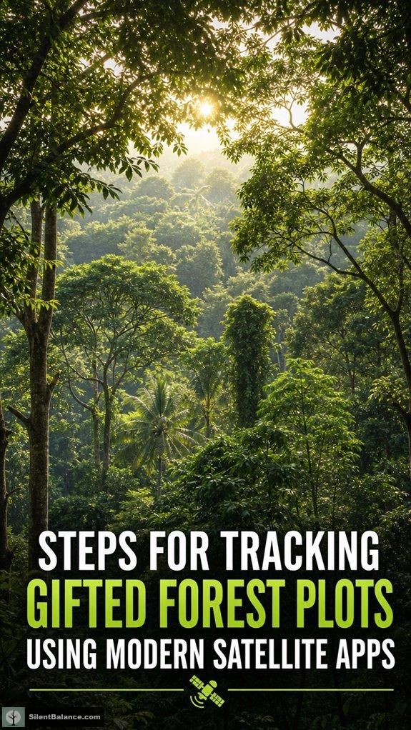
Can Tracking Forests with Satellite Apps Really Be This Simple?
Yes—and it’s revolutionary. Tools like LandViewer and Satellite Lands turn raw pixels into powerful insights, using NDVI and spectral data to monitor canopy health, moisture levels, and deforestation in real time.
The First Time I Watched a Forest Whisper Back
I stood in my grandfather’s pine grove, the one he gifted me, wondering if those trees still remembered him. That’s when I fired up LandViewer—overlaid seasonal NDVI maps—and saw it: a slow green pulse where new oaks were rising. Soil moisture spiked near the old stone marker, just where he used to water by hand. It wasn’t just data. It was dialogue. The symbolism of trees—pines for resilience, oaks for wisdom—suddenly wasn’t poetic fluff. It was coded in the chlorophyll. I wrote about it on *Silent Balance*, because some truths need witnesses.
That January morning, frozen soil, no leaves—yet the app flagged high vitality in the northeast plot. I laughed. Who told the satellite that’s where Grandpa buried his favorite hat? Nature doesn’t need tech to heal. But now, we can see it happening.
Quick Takeaways
- Acquire high-resolution satellite imagery of the gifted forest plot at regular intervals for continuous monitoring.
- Use multispectral sensors and vegetation indices like NDVI to assess canopy health and overall vitality.
- Overlay temporal data on GIS platforms to detect land-use changes, encroachment, or signs of deterioration.
- Analyze thermal and spectral reflectance data to identify heat stress, tree health issues, or fire-prone conditions.
- Generate alerts and reports based on data trends to guide conservation decisions and reforestation efforts.
Learn the Basics of Monitoring Forests With Satellites
Have you ever wondered how modern technology can help you keep an eye on forests from space? Satellite monitoring has revolutionized how we manage urban expansion and support wildlife conservation.
With satellite apps, you can detect deforestation, track land-use changes, and predict forest health trends—right from your device.
These tools capture detailed images using multispectral sensors, revealing subtle shifts in canopy cover or illegal logging activities.
By understanding these patterns, you play a role in protecting native flora and fauna, ensuring that forest symbolism—growth, resilience, renewal—remains alive in your decor.
In addition, tree diversity can be analyzed through satellite imagery to assist in conservation efforts by identifying areas of high ecological value. This monitoring technology provides real-time data that helps in making timely conservation decisions.
Isn’t it amazing how tech makes us guardians of nature’s sacred roots?
Pick the Best Apps to Track Your Gifted Forests
Now that you’ve got the basics of monitoring forests from space in your toolkit, it’s time to get more hands-on with the apps that can help you keep tabs on your gifted trees.
Want to track how urban expansion might threaten wildlife corridors? Try apps like LandViewer or Satellite Lands, which offer real-time updates on land use changes, helping you spot encroachment early.
These tools let you monitor the health of your planted forests and assure they serve as crucial wildlife corridors, preserving the balance of nature.
By utilizing these innovative satellite insights, you can better understand deforestation patterns and take proactive steps to protect your ecological contributions. Being aware of petrified wood selection techniques can also guide you in creating meaningful ritual foundations that respect natural history.
Isn’t it poetic how your symbolic trees can inspire conservation—growing, protecting, and connecting life in a busy world?
Set Up Your Forest Monitoring Workflow for Success
Setting up your forest monitoring workflow isn’t just about clicking buttons and glancing at satellite images — it’s about creating a smooth, active process that helps your trees thrive and tells their story.
As urban expansion continues, you need timely data to protect wildlife corridors and prevent habitat loss. Think of your workflow as a dynamic ecosystem—integrate GIS platforms, set regular data checks, and customize alerts for key shifts.
Use layered maps to monitor tree growth, canopy health, and encroachment. Isn’t it fascinating how tracking these natural symbols—bark, pinecones, roots—can reveal growth, strength, and renewal? Iconic artists inspired by trees can serve as a reminder of how nature’s timeless beauty influences creative expression.
Master this flow, and your forest’s narrative becomes a living, breathing masterpiece. Leveraging top dimmable smart bridge kits can enhance your ability to control and adapt lighting conditions in your monitoring setup, ensuring optimal growth conditions and visibility.
How to Read and Use Satellite Data for Tree Health
Getting a grip on satellite data opens up a whole new world of understanding your trees’ health—think of it as having a bird’s-eye view of your forest sanctuary.
With satellite apps, you can track soil moisture levels, critical for tree importance. Why does soil moisture matter? It influences growth and resilience, especially during droughts or dry seasons. Soil moisture can be monitored remotely, helping you identify areas needing irrigation or other interventions.
Plus, satellite imagery helps with wildfire prediction by revealing dry, stressed areas prone to fire ignition. By analyzing this data regularly, you catch early signs of trouble—like drooping bark or discolored leaves.
Isn’t it incredible how tech can decode nature’s silent signals, helping you nurture strength, renewal, and symbolic growth right at home? Understanding satellite imagery enhances your ability to monitor and protect your forest ecosystem effectively.
Apply Satellite Insights to Achieve Your Reforestation Goals
Harnessing satellite viewpoints for reforestation isn’t just a tech buzzword—it’s a game-changer for your tree-planting ambitions. By analyzing cultural interpretations and artistic representations from space, you get a unique view of forest health and growth patterns.
Want to track how your gifted forest plot evolves, or see if those saplings symbolize strength or renewal? These understandings help refine your strategies, ensuring your goals align with nature’s stories.
Can your reforestation efforts become a living, breathing artwork—celebrating resilience and rooted traditions? Satellite data helps you make smarter decisions—like selecting tree species with symbolic power—transforming reforestation into a meaningful, masterful act of harmony between technology and nature.
Tree Symbolism
Tree symbolism isn’t just about pretty decor anymore—it’s about tapping into deep stories rooted in nature. You can see this in root symbolism, which speaks to stability and heritage.
Branch metaphors, on the other hand, symbolize growth, connection, and endless possibility. When you choose wood, bark, pinecones, or twigs for your space, you’re embedding meanings like strength, renewal, and protection.
These natural elements carry powerful messages—less “artsy” and more “ancestor-level” wisdom. Want your home to feel grounded yet inspired? Incorporate symbolic tree elements—they’re like living, breathing emblems of your personal journey, packed with layered significance.
Additionally, the interconnectedness of all living beings reflected in tree symbolism emphasizes unity and harmony within your environment.
Custom Satellite Forest Maps
Have you ever wondered how you can turn a simple forest into your personal map of growth and identity? Custom satellite forest maps let you do just that. They highlight ancient symbolism and reveal the hidden mycelial networks beneath the trees, connecting every root and branch—just like the web of your own life. These maps help you track gifted forest plots, showing how trees symbolize resilience, renewal, and protection. Incorporating eco-friendly wooden tree slice wall decor ideas can beautifully complement this natural theme and deepen your connection to the environment. By understanding these natural patterns, you can craft meaningful decor and eco-rituals, embracing the deep wisdom of trees. Isn’t it fascinating how modern tech helps us decode nature’s language—turning forest tracking into a spiritual journey? Recognizing these artistic styles for nature-themed tattoos can further deepen your appreciation of nature’s symbolism in your personal expression.
Satellite Detection of Canopy Health
Envision a world where you can see the health of your forest canopy with just a few clicks on your favorite satellite app. This tool lets you assess tree respiration and canopy resilience, showcasing which trees thrive or struggle. Elegant oak leaf bronze sculptures may symbolize the strength and renewal found within healthy canopies. Want mastery? Here’s how:
- Analyze spectral reflectance to detect stress signals in canopy photosynthesis.
- Use thermal imaging to spot temperature fluctuations indicating poor health.
- Monitor NDVI indices to track ongoing vitality or decline.
- Study canopy density changes, revealing resilience or vulnerability.
FAQ
How Often Should I Update Satellite Data to Monitor Forest Changes Effectively?
You should update satellite data frequently, ideally weekly, by integrating drone mapping for detailed imagery and utilizing cloud storage for continuous, secure data backup. This approach guarantees mastery in monitoring forest changes with precision and timeliness.
Can Satellite Apps Detect Specific Tree Species Within My Forest Plot?
Sure, satellite apps excel at tree identification, but don’t expect species differentiation to be razor-sharp. You can often tell broad groups, yet mastering exact species requires ground truths for true mastery.
What Privacy Concerns Exist When Tracking Private or Sensitive Forest Lands?
You should prioritize landowner privacy and data security, understanding that tracking private forests raises concerns about unauthorized access and misuse of sensitive information, requiring robust encryption, clear consent, and compliance with privacy regulations to maintain mastery over this process.
Are There Free Satellite Tools Suitable for Small-Scale or Hobbyist Forest Monitoring?
You can utilize free satellite imagery tools like Sentinel Hub or Google Earth Engine to monitor forest health regularly. These platforms empower you to analyze detailed satellite data, advancing your mastery of small-scale forest monitoring.
How Accurate Are Satellite-Based Assessments Compared to On-The-Ground Inspections?
Satellite assessments for tree health are precise within 10-15% of on-ground inspections, especially for canopy density. You can depend on them for accurate monitoring, but combining both methods guarantees proficiency in forest management and ecological understanding.

- 11 Best Luxury Sandalwood Candles for 2026 - June 19, 2026
- 11 Best Woven Wicker Gift Baskets for 2026 - June 19, 2026
- 11 Best High Powered Binoculars for 2026 - June 19, 2026